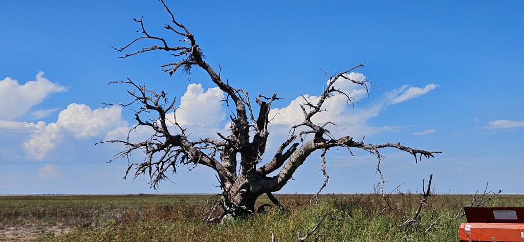
You should know first that it is a particular dead tree in southwestern Kansas, about 29.5 miles north of the Oklahoma border and 26 miles east of the Colorado line. That’s as the crow flies. Even though you’re not a crow, track distances well: if you go 27 miles east of that line, you run the risk of confusing the dead tree with two living ones. A crow would not be so confused.
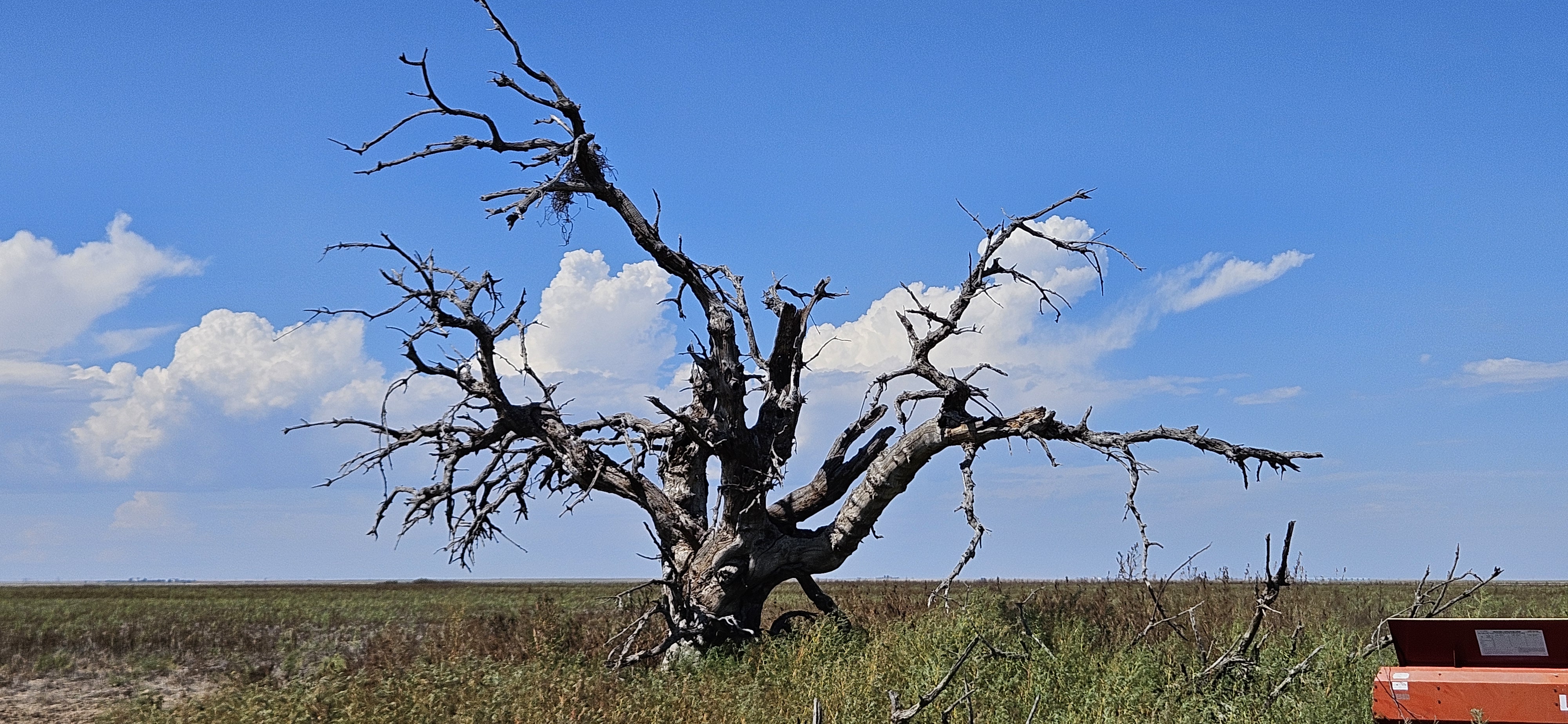
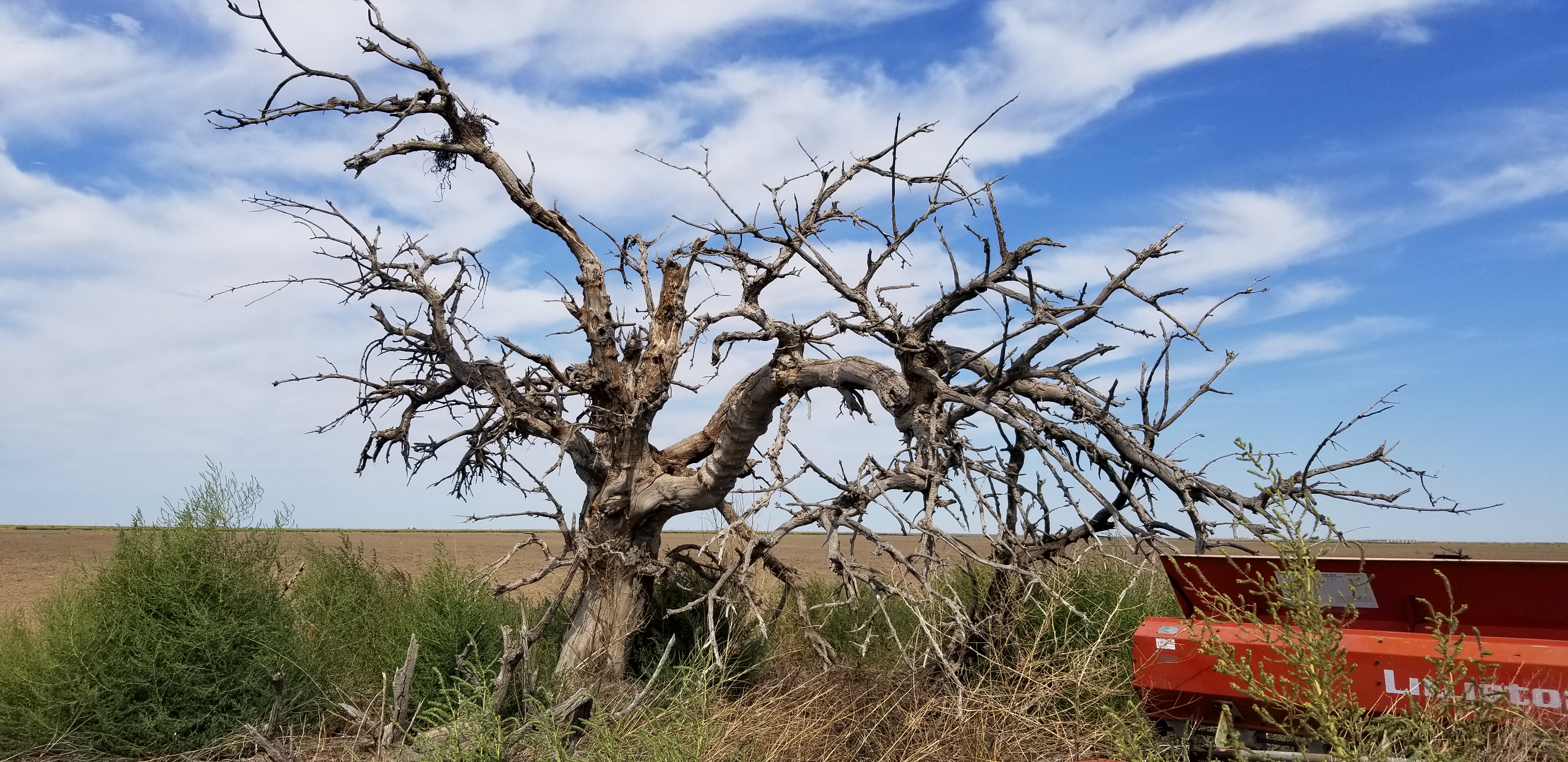
The dead tree has been such for the twenty-some year span that I’ve known and relied on it as a landmark. Members of two prior generations of my wife’s family similarly benefitted from the tree as a guidepost to get to a particularly lonely field in their agricultural holdings. They also benefited from the shade it once offered to visitors and passers-by. My mother-in-law, for one, delighted to visit such trees for a break in her travels to meet with farmers. She’d enjoy a cigarette, a book, and a Coke from the cooler. Now, however, lacking the vitality of foliage, the tree’s bare branches and trunk cast a diminished and diminishing umbra as they lose twig and bough. Surrounding it, weeds that once would have been shaded out luxuriate in the sunlight and give dense cover to rodents, snakes, insects and birds.
You should second know why trees, dead or otherwise, bear importance as a navigation tool: if you are wise enough to pay attention to such things as dead trees, it is a conspicuous marker in an uncluttered landscape, a landscape where roads have been assigned letters and numbers, but the signs that bear such identifiers are often faded, toppled, or were never put up to begin with. It is also a landscape where wireless service disappears in low spots and the capacity to send a GPS pin or to navigate using one can’t be assumed. Then, too, GPS will tell you that there is a road where no such thing exits. In such country, it is best to start with directions from a known and identifiable intersection, then track distance covered from it and subsequent turning points by using a trip odometer. Yes, tenths of a mile matter. Thus it’s a great relief to have a landmark or two to confirm the math that you’ve done in your head while driving on an unpaved road at 45+ mph past fields that look not altogether unlike the fields you’ve been passing throughout your day already. Thus, as my in-laws passed this navigational methodology and their landmarks to me, I pass them on to my kids so that they can find their way to lonely fields. With luck, the tree will remain vertical longer than I do so that it can continue to point the way for another generation.
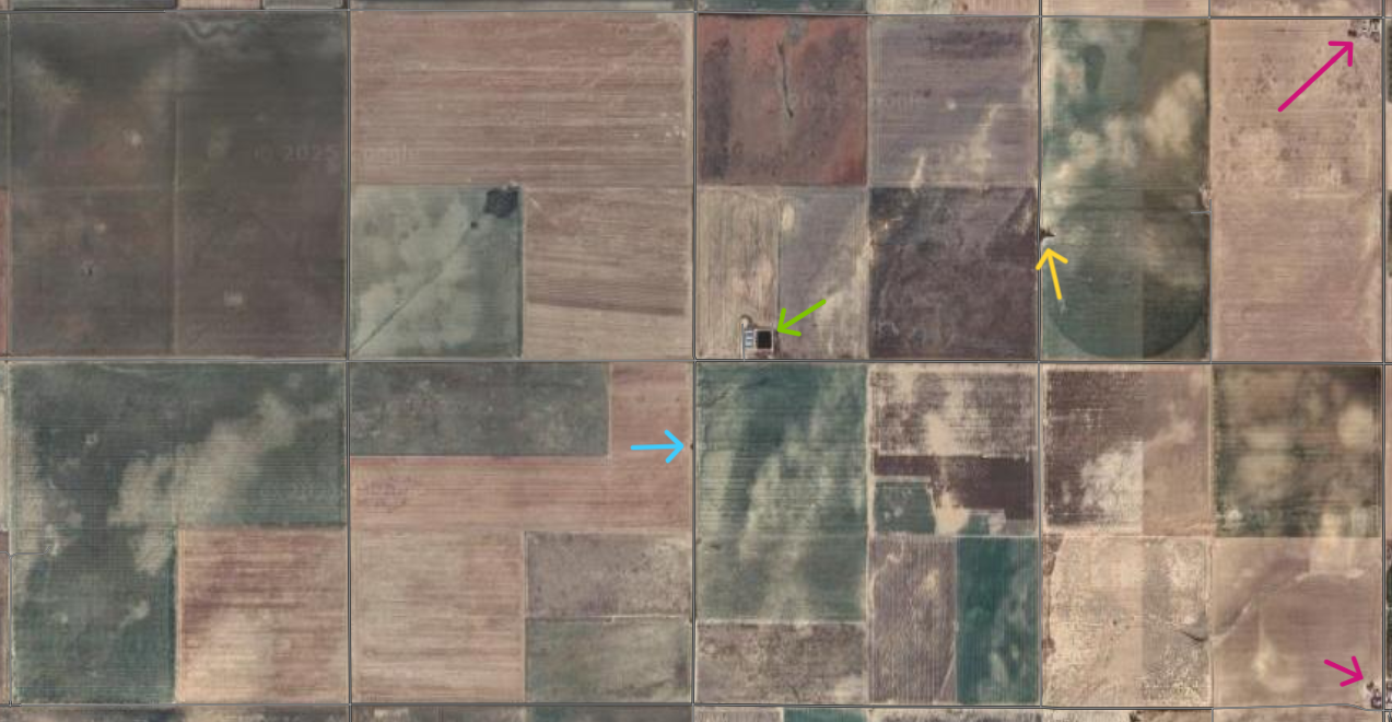
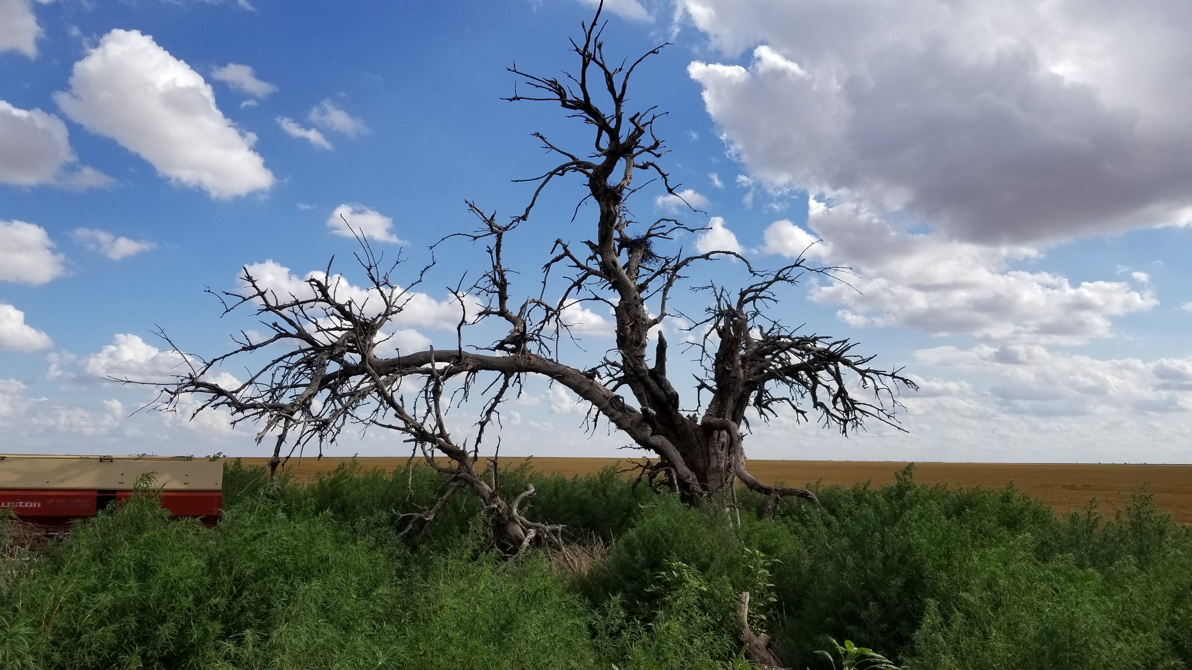
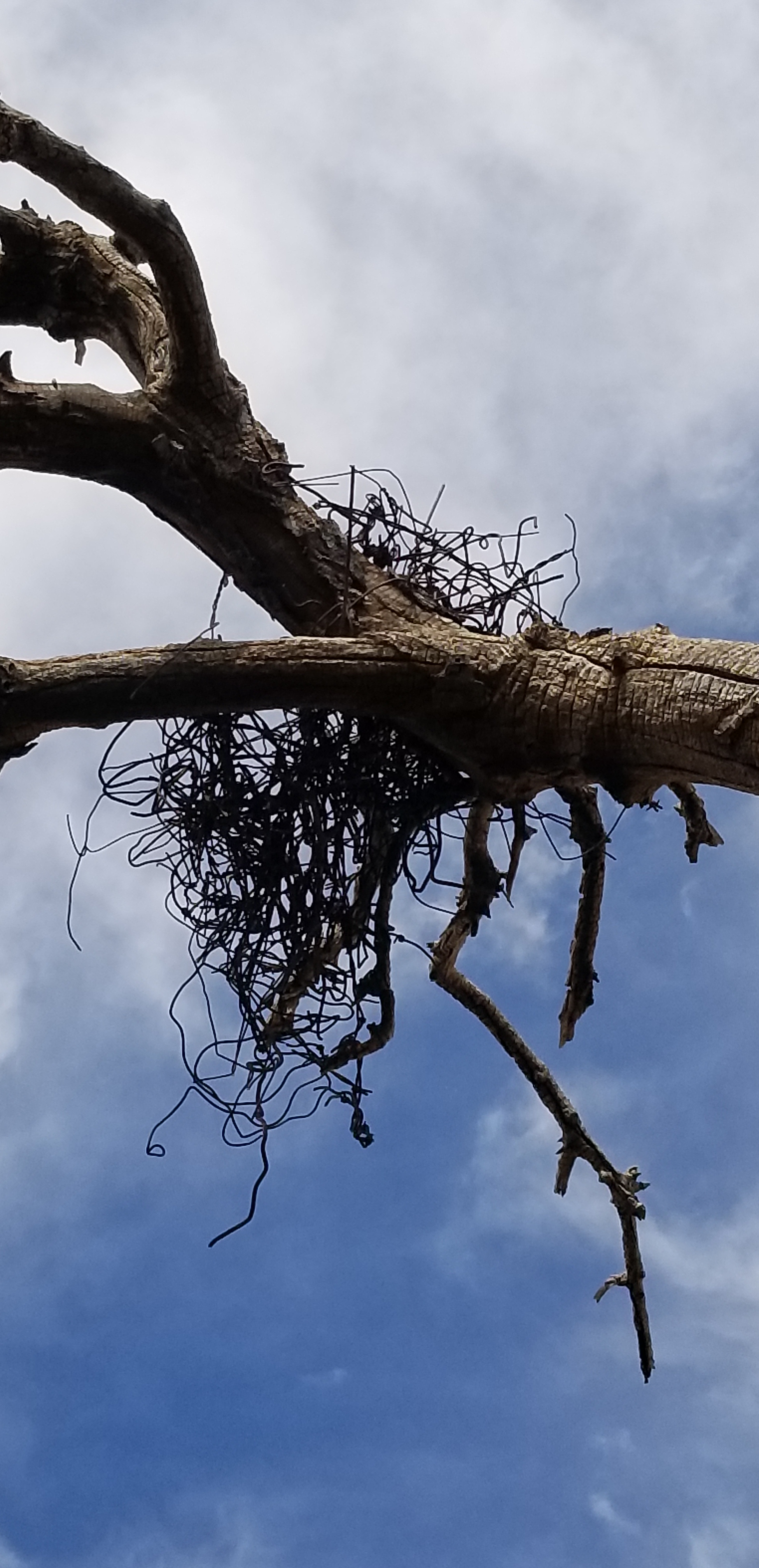
Third, you should know a bit more about where this particular dead tree is: it stands easily visible halfway down the eastern edge of another farmer’s quarter section[1] along a tire-track road (trail road) that serves as the only route of access for several other parcels of ground, including our lonely parcel. Over its length, the trail road can be rough, eroded by run-off after heavy rains, torn up by the tires and weight of pick-ups, tractors, and grain trucks passing to and from the agricultural land that the road touches. The trail road runs for a mile and starting and extending south from a nicely graded and maintained dirt county road. (The county road is the midline in the satellite image above). The nearest pavement (a KS state highway) is three miles to the west. The intersection of the state highway and the county road is, consequently, the critical starting point in directions to the lonely field: At the intersection of Hwy XX and Road yy, turn east and continue for three miles, looking for the dead tree that’s a quarter mile south of that road. When your vehicle is in line with the tree, turn south (right) onto the trail road (Road Zeta). Go 1/4 mile south and pay your respects to the dead tree, then continue another 3/4 of a mile down the trail road. If you need confirmation that it’s the proper dead tree, look for the wire nested in the branches and the decrepit orange planter that is sitting in the weeds beside the tree. Those features should be unnecessary confirmation, though, since there isn’t another tree, living or dead, in view.
The importance that I assign to the dead tree makes me feel as if I should know more about how it lived. The three big questions (and several follow-ups) I’d ask are:
- What is your life story? Who planted and watered you, or are you one of the rare, rare volunteer trees that can germinate and survive for decades in suchdry ground that is so far from a streambed? If planted, did you shelter a family and their home, or was your shade for the benefit of their livestock? For what it’s worth, I’d bet that you were planted and valued, and perhaps are standing yet today because some child of that family remembers you.
- What species are you and for how many years did you green up in springtime? Where do you stake the beginning and end of your life? I’d guess that both fall within the 90-year arc of time since the era of the Dustbowl. Or did you get a start during those cruel years? It’s hard to picture a young tree making it through a time when fence lines, structures, and life (plant and animal) were scoured by wind, dust, and grit and often interred beneath masses of wind-drifted soil.
- What birds made their tough-as-nails nest in your branches? The abandoned baling wire scraps and fencing material that they unearthed and wove into the wide foundation of a roost in the crotch of your upper branches suggest a certain mass, as well as ingenuity and hardiness. Crows? Raptors of some kind? No matter how hardy, they lined the wire foundation with softer stuff, right? How many clutches came to hatch there? Which was the longer burden you bore, offering a home to avian squatters or bestowing shade upon humans who have transformed the high plains of Kansas? And which was burden was the lighter?
Such are the questions I would ask the tree.
Trees, crows, and we humans alike experience transitory lives. However, neither their lifepans nor their passings-on are the same. Birds and people both naturally change location in their lifetimes. And both give up their existence and physical manifestation on earth in short order as the whims of time, circumstance, and decomposition do their thing. Nature, in contrast, makes both the upright life and the crumbling decay of a tree happen in situ and in plain sight with the tree acting as a witness of its place in the world for decades after its lifespan. I would accordingly be inclined to end my questioning of the dead tree with two expressions of gratitude, one for its service pointing the way to a lonely field, one for its significance beckoning me to reflect on and value greater spans of time than that of the shadow that I will have cast upon the ground.
[1] See my prior post, Where the Deer and the Surveyors Play, to learn more about sections (1 mi. by 1 mi. parcels of land, i.e. 1 square mile) and quarter sections (.5 mi. by .5 mi. parcels of land, i.e. .25 sq. mile or one fourth of a section).
